Posts

Showing posts from 2015

I blew out my data

Image
Controlling your data When you are on the road you don’t have the luxury of large amounts of data at a home plan rate. Wireless data is expensive whatever country you are in, and the USA is no different. When we came into the USA a few months ago, we blew out our data plan four times! Unlike home plans, they don’t just throttle you back - they give you another gig and charge you double than if you had included it in your plan, and when you’ve used that they give you another one. We thought we were being very careful, and while it has never been this bad, it has happened before. So it was time to find some answers and fix the problem! Fixing the problem Firstly I went into my System Preferences on my Mac and then: Under Notifications - I turned off all notifications on every application, except Tunnel Bear. I use Tunnel Bear on my laptop to make a secure connection for banking or accessing my passwords when I’m using a public WiFi. You need to know when the line is secure, so

Campground Review - Cathedral Springs CA

Image
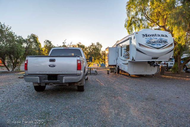
Site 41 Cathedral Palms RV Resort 35901 Cathedral Canyon Drive, Cathedral City CA Why we chose here? We were meeting up with friends in Palm Springs, Cathedral City and Palm Desert Location: In between Palm Springs and Desert Springs, CA Sites: 145 – 33 50 amp FHU, 14 E & W, all the rest are FHU 30amp Facilities: Pool, Recreational room, pickleball court, restrooms, free wifi Groceries: shops are a 7 minute drive away Reservations: Yes Cell Coverage / WiFi: Their Wifi was unusable at our site, it is strongest in the recreational room Price Paid: $43 + tax Date of visit: December 2015 Other: We were in site 41, wifi was terrible and we had noise from the equipment hire place next door using air compressors. Would we come here again? Not sure, we would look at alternatives first.

Wrapping up 2015

Image
Watson Lake AZ After the dentist in Yuma we went north to Cave Creek in AZ to catch up with our friends Bill & Michele. Lindsay took the opportunity to get the truck and trailer detailed to keep it looking good. One of the days we went up to Prescott to have lunch and then onto Watson Lake, which is really pretty. Another day we took a picnic up to Yellow Cliffs at Bartlett Lake in the Tonto National Forest. Yellow Cliffs, Bartlett Lake AZ A first for us was meeting up with a couple whose blog I follow – Mona-Liza and Steve. They were staying in nearby Cave Creek state park, less than 10 minutes from where we were. We spent a couple of hours drinking red wine and swapping stories. They have been to Australia where Mona-Liza fell in love with sticky date pudding, it just happens to be one of my specialities, so I've sent her the recipe. They have been to nearly every state in America, so have lots of information and ideas that I will be able to use for our upcoming No

Going to the dentist in Mexico

Image
Mittry Lake Yuma Dentist in Los Algodones? If you are thinking of going to the dentist in Los Algodones, Mexico Here are some things you might want to know…these are based on our experience How do I get there? From Yuma travel along the I-8 going towards San Diego, turn left at the Los Algodones sign. Quechan casino is on the corner. Go down this road until you can see the border crossing ahead of you. There is a parking lot to the right, turn into these gates and drive around to the entry booth. In 2015 the fee for parking is $6, cash. You then just walk across the border. No-one will ask for your passport on entry, but you will need it to come back into the USA. Towards the end of the day, the line to come back in can be quite long, so try and make an appointments as early as possible. Part of the walkway is undercover, but take a hat. Where do I stay? You have a few choices, either a motel/hotel in Yuma or in Los Algodones; or If have an RV: Yuma has many RV park

San Diego Sunshine

Image
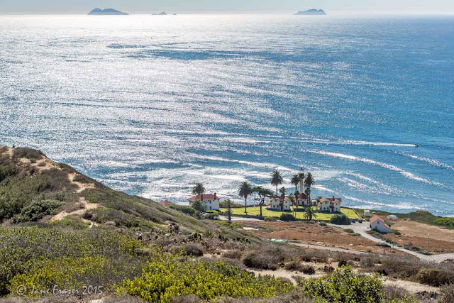
Lighthouse on Point Lomas San Diego is touted as having the best weather in America, so I looked forward to going there. It didn’t disappoint, the days were warm and sunny. I found a lovely county park in Bonita, near Chula Vista just south of San Diego which I booked thinking that it would be busy. It wasn’t, in fact there were many places vacant. Our first trip out was to Point Loma. Cabrillo National Monument is there as some explorer arrived back in the 1700’s, a lighthouse, in fact two because the first one was in the wrong spot, and a military base as this land was very vulnerable during WWII and was a way of protecting San Diego bay. I had wondered why some of the most sought after land was a park and not residential, now I know. There are some rock pools there also which you can access at low tide but of course we weren’t there at the correct time. What you do get though, is a fantastic view of San Diego from the water. Looking over San Diego Bay A number of people

Campground Review - Near San Diego CA

Image
Site 31 Sweetwater County Park Campground 3218 Summit Meadow Road, Bonita CA Location: South East of San Diego, near Chula Vista Why we chose here? Near San Diego Sites: 150, The South loop has partial shade sites with gravel pads. Number of: 7 FHU, 41 W&E, 12 W&E Equestrian. Pull throughs on the inside of the loop, back-in on the outside. The North Loop has no shade but with concrete pads, nearly all pull throughs. Number of sites: 51 FHU Facilities: Dump, Community Center, Trailheads, Restrooms, Showers Groceries: Chula Vista Reservations: Yes $5 fee. It was less than half full when we were there, we did not need to register after all, but you never know. Even on the weekend, it was only half full. Cell Coverage / WiFi: Verizon works here, but there is a free wifi at the office near site 32 Price Paid: $33 FHU, $29 W&E Date of visit: Mid November 2015 Would we come here again? Yes. This is a lovely campground. Our site #31 FHU was huge

Campground Review - Boondocking in Anza-Borrego Desert CA

Image
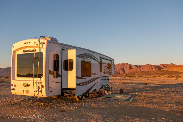
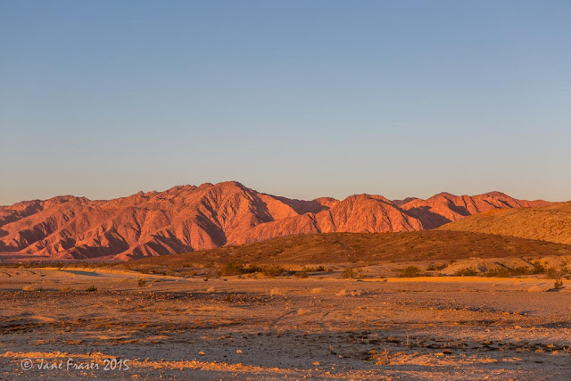
Rockhouse Trail  A campsite on the right hand side of the trail Why we chose here? We were on our way to San Diego Location: Rockhouse trail is off the SR22 in the Anza Borrego Desert CA. Two hours east of San Diego, west of Salton City, near the Salton Sea. There is a green street sign, so you shouldn’t miss it. More than likely there will be other RV's there as it's a well known boondocking area. Sites: Quit a few, look for the rock ringed fire pits Facilities: None, it’s primitive camping Groceries: 7 miles to Borrego Springs Reservations: No Cell Coverage / WiFi: Both Verizon and AT&T work here. The further you go from the SR22, the weaker the signal Price Paid: $0 Date of visit: Mid November 2015 It's just a big open space Other: This is a low desert so has the same temperature as say Palm Springs. There can be high winds as this is a desert. Fuel and food are available in Borrego Springs 7 miles away The road at

Land of the Giants, Past and Present

Image
Anza-Borrego Desert State Park, California 6am outside our Trailer After spending some time in Yucca Valley catching up with friends and getting a few maintenance issues done such as brakes and wheel bearings on the trailer, brakes, tyre balancing and front end alignment on the truck. It was time to find somewhere warmer. Winter had come early and being in the high desert it was starting to get cold. Day light saving ended and it was getting dark around five. We had five days before we were due at the state park near San Diego in mid November, so we didn’t want to go too far afield. Anza-Borrego Desert State Park is a low desert east of San Diego and west of the Salton Sea. There is a difference of 10°F between the low and high desert, and the difference between 60° and 70° can mean that you are a bit cold or nice and warm. Low desert sounded good. We are boondocking here in ABDSP, one of the few State Parks that allows primitive camping for free. Our neighbours are a few

Bend and beyond

Image
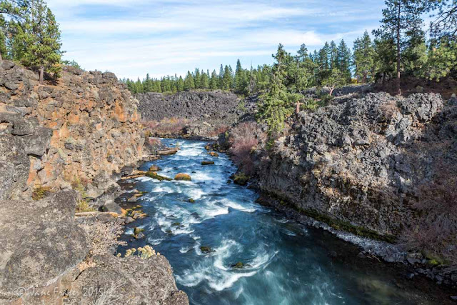
Dillon Falls Bend is only a short drive from Mitchell OR, so it was a nice short haul. I had planned to stay in Tumarlo State Park but as two loops had been closed for winter there were only a few sites vacant. They were either too small for us or we could only stay one night at a time, due to reservations so we looked elsewhere. We found the Expo campgrounds in Redmond just north of Bend. It had large sites, a great layout and a nice laundry. We’d done some online shopping and had it delivered to the Bend Post Office. It was supposed to be free delivery but because they had used a courier, the Post Office charged us delivery from the point of origin to Bend again, as a penalty for not using their service. Lindsay tried to argue with them, but got nowhere. Will try not to make that mistake again. Bend Waterfalls I wanted to photograph the Tumarlo falls but they were closed off due to a new pipeline being built. These falls are supposed to be the highest in the area and I h

Campground Review - Boondocking near Painted Hills OR

Image
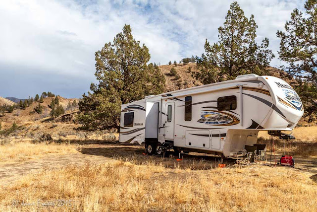
Boondocking site - Mitchell OR Our site on the left as you go in the gate Why we chose here? It is close to the Painted Hills unit of the John Day Fossil Bed National Monument Location:  Burnt Ranch Road. About 1.5 miles from the corner of the Ochoco Highway and Burnt Ranch Road. It is 4.5 miles to the Painted Hills. You can see it from the road, you can't miss it. View from out site There are two other BLM campgrounds further on past the Painted Hills unit. If you go to the BLM branch in Prineville they will give you a map which shows all camping and services in the area. This one is not marked on the map. Sites: about 6. When you drive in, you have the choice or right or left. The right one is on a bit of a slope and you will probably have the area to yourself. This is the one we stayed in. Facilities: None Groceries: Shop before you come Reservations: No Cell Coverage / WiFi: None, the nearest cell/data service is at Mitchell about 3 miles

Cheetahs, Tigers, & Camels once roamed Oregon

Image
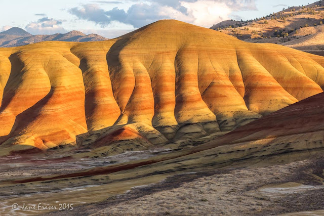
Painted Hills, it took me four trips to get sun on the hills Would you believe it? The John Day fossil beds have uncovered the bones of many extinct animals that roamed the grasslands and forests up to approximately 55 million years ago. The region was home to camels, elephants, three-toed horses, rhinos, cheetahs and tigers, amazing but true. the first afternoon that we arrived, the sun was out The John Day fossil beds encompass three units: the Painted Hills, the Clarno and Sheep Rock. We based ourselves near the Painted Hills and did a day trip to Sheep rock. There are a number of short trails at the Painted Hills and we walked the Carroll Rim trail (1.6 miles), The Painted Hills Overlook Trail (0.5mi) the Red Hill Trail (0.25mi) and the Painted Cove trail (0.25mi). The whole time we were there it was overcast which made getting a photo very difficult. There are signs everywhere asking people not to walk on the hills as they are very delicate and once there are f